The devastating fires in California in November, the earthquake in Indonesia, the explosive eruption of the Kilauea volcano in Hawaii, the drought in France, ... but also the construction of facilities for migrant children in Texas, or the development of roads and buildings on a remote island in the Bay of Bengal to accommodate 100,000 Rohingyas, ... They see it all! "They" are Planet's satellites, which photograph the Earth every day. Thanks to this fleet of microsatellites, a retrospective of images from space, like a "slide show", is offered to us on the key events of 2018.
L’he year 2018 has been an eventful one. Planet, a specialist in satellite imagery and data analysis, operates the largest fleet of microsatellites in the world and collects an impressive amount of images on the evolution of the planet on a daily basis. The company designs, builds and operates more than 150 satellites, and develops the software and online tools that return the data to users.
Satellite imagery provides a unique perspective of events happening on Earth and helps businesses, governments, NGOs and first responders to better understand the physical aspects of events around the world in order to make more informed decisions. Here is a slideshow of eight of the most significant events of 2018 as seen from space.
8 highlights in 2018 seen from Space
An island camp built to house the Rohingya house

As of May 2017 © 2018 Planet Labs, Inc.
The development of roads and buildings on a remote island in the Bay of Bengal indicated that Bangladeshi officials were preparing an island to accommodate 100,000 Rohingyas.
Seventeen years ago, this island didn't exist. It formed naturally as the river flowed and the tides deposited silt in the area. Today, Bangladeshi officials are preparing the island - an effort that is expected to cost $278 million - to house people fleeing persecution in Myanmar. Streets are being laid out and flood barriers are being constructed, as well as buildings.

April 2001 © 2018 Planet Labs, Inc.
The UN refugee agency says more than 600,000 people have fled Myanmar in Bangladesh in the past six months. Reuters reports that the camp will house about 100,000 people.
Construction of facilities for migrant children in Texas

Tornillo Camp © 2018 Planet Labs, Inc.
A temporary tent city is being built in Tornillo, east of El Paso, Texas, to accommodate thousands of migrant children. U.S. President Trump signed an executive order to end the process of family separation he had created, but at least 2,500 children have already been abducted from their parents and sent to shelters in at least 15 U.S. states. Hundreds of them have been separated from their distraught parents for several weeks. The system for reuniting these children with their parents arrested for illegally crossing the border is chaotic, so the humanitarian crisis could last for months.
Across the United States, the federal government is responsible for the care of approximately 12,000 migrant children in about 100 homes, 2,500 of whom have been removed from their parents in the past five weeks. The rest are young people who have crossed the border alone.
In Texas, there are 32 licensed institutions for migrant children. The temporary tent camp in Tornillo needed to expand to accommodate young people still forcibly separated from their families. (Source: Washington Post, June 25, 2018).
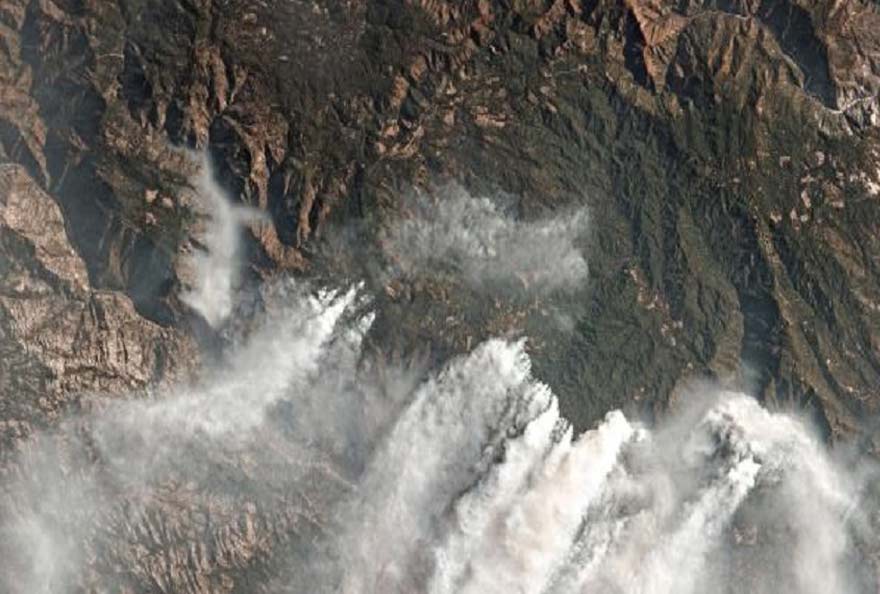
A devastating fire burns in Northern California...

Camp Fire © 2018 Planet Labs, Inc.
Just four hours after the Camp Fire fire in Butte County, California, satellites Dove from Planet captured some of the first images of the fire.
The fire broke out at about 0630 on November 8, after power lines malfunctioned and rapid winds scattered sparks through the arid brush at Paradise. The flames swept across the valley at an incredible rate in a matter of hours, overcoming roads full of fleeing residents.
At 10:30 a.m., a tiny satellite flew over the fire capturing images and relayed them to Planet's headquarters, 160 km from the fire.
Tara O'Shea, a Planet executive working on forestry issues, had met with government emergency management officials to explain how satellite imagery could help prevent forest fires by measuring the dangerous accumulation of dead and desiccated brush.
Of course, the California Office of Emergency Services called: Could Planet give them an overview, as soon as possible? Brittany Zajic, who works on disaster response at Planet, jumped in a car the next morning with one of the company's engineers and drove to Sacramento, where they plugged the state's emergency operations center into their imaging platform.
"It is absolutely essential that we take advantage of all existing technologies, including emerging technologies such as remote sensing, said Mark Ghilarducci, Director of the State Office of Emergency Response.. "High-resolution satellite imagery in the present moment, before, during and even after a disaster, is a wealth of valuable data that first responders and emergency managers can use to make decisions. »
Planet's satellite took this first picture because its space network Dove is designed to capturing every piece of the Earth's landmass every day, a frequency unmatched by other commercial satellites. As the forest fires in California broke out, this frequency provided state emergency responders with "daily situational awareness," including identifying overcrowded evacuation sites and assessing fire damage on a property-by-property basis.

Paradise - Counter-intuitively, in these images, healthy vegetation is red, while burned areas appear in black © 2018 Planet Labs, Inc.
With these images, emergency officials can instantly report on property damage. This information is not only important for obtaining emergency assistance from the federal government, but also for local officials to show the extent of the damage their citizens and property are facing.
When it comes to monitoring forest fires, options such as UAVs, helicopters and airplanes have difficulty observing smoke and flying in high winds. Satellites are changing the landscape for fire monitoring.
The rPlanet's relationship with California began with a partnership for the construction of a new satellite to monitor climate change, announced in September. Planet's founders are former NASA researchers, and several members of its team have spent their careers developing the technology to measure how global warming is changing the planet.
" It's a frightening reality, it's our new reality", says Mr. O'Shea. "Personally, I came to Planet because I think this data set has real potential for climate solutions. »
Devastation in Indonesia

Palu before the Tsunami © 2018 Planet Labs, Inc.
An earthquake and the resulting tsunami in Palu, Indonesia, caused devastating damage, killing more than 1,200 people, destroying thousands of buildings and displacing more than 61,000 people. Satellite images, taken three days after the earthquake, show the considerable impact of the disaster with much greater damage than could be seen in ground photos.

Palau after the tsunami © 2018 Planet Labs, Inc.
The violent eruption of Kilauea volcano

Pahoa, Hawaii in September 2018 © 2018 Planet Labs, Inc.
The explosive eruption of the volcano Kilauea on the island of Hawaii in May 2018 unleashed a dangerous ash cloud at an altitude of more than 9,000 metres, covering the once serene Leilani area in the heart of the Polynesian jungle.

Pahoa in December 2009 © 2018 Planet Labs, Inc.
Kīlauea has been erupting almost constantly since 1983, sometimes explosively, throwing clouds of ash and lava into the atmosphere, and sometimes more volubly, letting magma flow over the surrounding rocks. So much magma has overflowed along its flanks that almost everything visible on the surface is less than a thousand years old - a snap of the fingers from a geological point of view.
But the eruption that began in May is "unprecedented in modern times," Tina Neal, the scientist in charge of the Hawaii Volcano Observatory, told Hawaii News Now. (Source: National geographic)
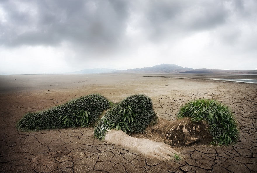
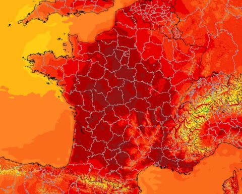
Drought in France
As of 23 October, 61 French departments are affected by water restrictions, according to the ministerial website Propluvia, which lists, at the national level, prefectoral decrees on water restrictions. From space, the drought is particularly visible in central and eastern France, the regions most affected by the drought.
-• Villers Le Lac (06/10/2016 vs 13/10/2018) - Doubs in the Burgundy-Franche-Comté Region
-• Baresia of the Ain (05/10/2017 vs 21/10/2018) - Jura, in the Burgundy-Franche-Comté region
-• Settons Lake (22/10/2016 vs 16/10/2018) - Nièvre, in the Burgundy-Franche-Comté region
Heatwave in Europe
-• Northern Europe also affected by the heat wave with temperatures around 34° in London.
-• In Germany - Koblenz August 4, 2018
-• Dunkerque also got a little hot
Fires in Sweden

Karböle area on 27/07/2018 © 2018 Planet Labs, Inc.
Sweden recorded the warmest July in at least two and a half centuries (33°). Some places have hardly seen rain in three months. No less than 25,000 hectares went up in smoke, twice the size of the city of Paris: 44 fires hit the forests of central Sweden and Swedish Lapland, above the Arctic Circle.
More information on www.planet.com
Header photo Camp Fire November 17, 2018 © 2018 Planet Labs, Inc.
Anything to add? Say it as a comment.